# imports
from collections import namedtuple
import numpy as np
import xarray as xr
import shapely
import cartopy
我手上的数据长这样。
我有一个感兴趣的区域(在这里定义为all_region)。我有一个包含变量的xr.DataArray。
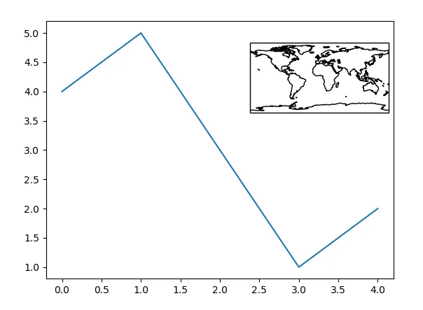
我想要做的是选择一个像素(纬度,经度对)并在线图的角落绘制一个小地图,显示该像素的位置。
Region = namedtuple('Region',field_names=['region_name','lonmin','lonmax','latmin','latmax'])
all_region = Region(
    region_name="all_region",
    lonmin = 32.6,
    lonmax = 51.8,
    latmin = -5.0,
    latmax = 15.2,
)

data = np.random.normal(0,1,(12, 414, 395))
lats = np.linspace(-4.909738, 15.155708, 414)
lons = np.linspace(32.605801, 51.794488, 395)
months = np.arange(1,13)
da = xr.DataArray(data, coords=[months, lats, lons], dims=['month','lat','lon'])
这些是需要修复以适配内嵌坐标轴的函数。
我有这些从xarray对象绘制我的时间序列和经纬度点位置的函数。
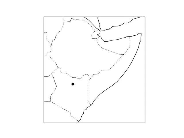
def plot_location(region):
    """ use cartopy to plot the region (defined as a namedtuple object)
    """
    lonmin,lonmax,latmin,latmax = region.lonmin,region.lonmax,region.latmin,region.latmax
    fig = plt.figure()
    ax = fig.gca(projection=cartopy.crs.PlateCarree())
    ax.add_feature(cartopy.feature.COASTLINE)
    ax.add_feature(cartopy.feature.BORDERS, linestyle=':')
    ax.set_extent([lonmin, lonmax, latmin, latmax])

    return fig, ax


def select_pixel(ds, loc):
    """ (lat,lon) """
    return ds.sel(lat=loc[1],lon=loc[0],method='nearest')


def turn_tuple_to_point(loc):
    """ (lat,lon) """
    from shapely.geometry.point import Point
    point = Point(loc[1], loc[0])
    return point


def add_point_location_to_map(point, ax, color=(0,0,0,1), **kwargs):
    """ """
    ax.scatter(point.x,
           point.y,
           transform=cartopy.crs.PlateCarree(),
           c=[color],
           **kwargs)
    return
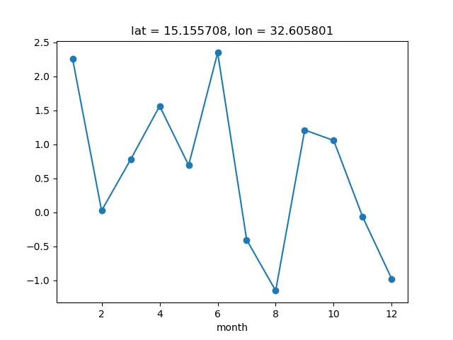
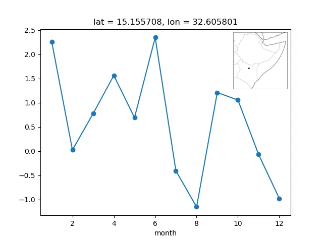
我在这里进行绘图
# choose a lat lon location that want to plot
loc = (2.407,38.1)

# 1. plot the TIME SERIES FOR THE POINT
fig,ax = plt.subplots()
pixel_da = select_pixel(da, loc)
pixel_da.plot.line(ax=ax, marker='o')

# 2. plot the LOCATION for the point
fig,ax = plot_location(all_region)
point = turn_tuple_to_point(loc)
add_point_location_to_map(point, ax)
我已经有一个绘制区域的函数,但是我想将其放在图形的角落轴上,像这样:
我该如何实现?我查看了inset_locator方法,但据我所知mpl_toolkits.axes_grid1.parasite_axes.AxesHostAxes没有分配投影的手段,而这对于cartopy是必须的。
from mpl_toolkits.axes_grid1.inset_locator import inset_axes

proj=cartopy.crs.PlateCarree
axins = inset_axes(ax, width="20%", height="20%", loc=2, projection=proj)

---------------------------------------------------------------------------
TypeError                                 Traceback (most recent call last)
<ipython-input-162-9b5fd4f34c3e> in <module>
----> 1 axins = inset_axes(ax, width="20%", height="20%", loc=2, projection=proj)

TypeError: inset_axes() got an unexpected keyword argument 'projection'