from shapely.ops import linemerge, unary_union, polygonize
from shapely.geometry import LineString, Polygon
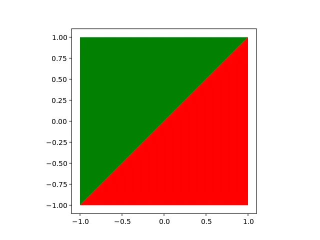
line = LineString([(-5, -5), (5, 5)])
polygon = Polygon([(-1, -1), (1, -1), (1, 1), (-1, 1)])
def cut_polygon_by_line(polygon, line):
merged = linemerge([polygon.boundary, line])
borders = unary_union(merged)
polygons = polygonize(borders)
return list(polygons)
def plot(shapely_objects, figure_path='fig.png'):
from matplotlib import pyplot as plt
import geopandas as gpd
boundary = gpd.GeoSeries(shapely_objects)
boundary.plot(color=['red', 'green', 'blue', 'yellow', 'yellow'])
plt.savefig(figure_path)
result = cut_polygon_by_line(polygon, line)
print(result)
plot(result)
print(result[0].intersection(result[1]))
结果是:
[<shapely.geometry.polygon.Polygon object at 0x7f50dcf46d68>,
 <shapely.geometry.polygon.Polygon object at 0x7f50dcf46da0>]
LINESTRING (-1 -1, 1 1)