我已经想出如何做到这一点。基本上,我只是创建了一个完整的点网格,然后删除那些不在对应于区域的形状文件中的点。以下是代码:
import geopandas
from geopandas import GeoDataFrame, GeoSeries
import matplotlib.pyplot as plt
from matplotlib.colors import Normalize
import matplotlib.cm as cm
%matplotlib inline
import seaborn as sns
from shapely.geometry import Point, Polygon
import numpy as np
import googlemaps
from datetime import datetime
plt.rcParams["figure.figsize"] = [8,6]
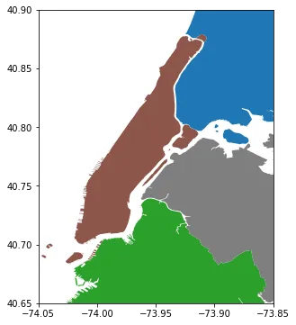
boros = GeoDataFrame.from_file('./Borough Boundaries/geo_export_b641af01-6163-4293-8b3b-e17ca659ed08.shp')
boros = boros.set_index('boro_code')
boros = boros.sort_index()
boros.plot(column = 'boro_name')
plt.gca().set_xlim([-74.05, -73.85])
plt.gca().set_ylim([40.65, 40.9])
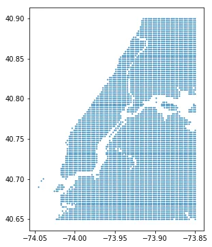
xmin, xmax, ymin, ymax = -74.05, -73.85, 40.65, 40.9
xx, yy = np.meshgrid(np.linspace(xmin,xmax,100), np.linspace(ymin,ymax,100))
xc = xx.flatten()
yc = yy.flatten()
pts = GeoSeries([Point(x, y) for x, y in zip(xc, yc)])
in_map = np.array([pts.within(geom) for geom in boros.geometry]).sum(axis=0)
pts = GeoSeries([val for pos,val in enumerate(pts) if in_map[pos]])
pts.plot(markersize=1)
coords = []
for n, point in enumerate(pts):
coords += [','.join(__ for __ in _.strip().split(' ')[::-1]) for _ in str(point).split('(')[1].split(')')[0].split(',')]
以下是所得到的图表:
我还得到了一个纬度-经度坐标矩阵,用于制作从城市中的每个点到哥伦比亚医学院的交通时间地图。下面是该地图:

以下是地图的局部放大版本,可以看到地图是由单个点组成的: