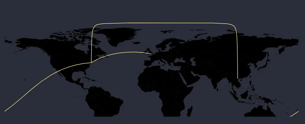
在 D3 地图上,曲线不连续。

5
我已经使用d3.js创建了一张地图。我想要在两个位置之间展示一条弯曲的线。我能够展示一条直线,但有时它无法形成一个完美的曲线。对于某些线路,线路会在地图后面(跨越本初子午线)弯曲到目的地。
这里是一个演示问题的代码笔: https://codepen.io/peeyush-pant/pen/WqbPax 还有一张图片:

enter image description here

这是我的投影数据:
var projection = d3.geoEquirectangular();

var path = d3.geoPath()
  .projection(projection);

这是我画线的方法:

  arcGroup.selectAll("myPath")
    .data(links)
    .enter()
    .append("path")
    .attr("class", "line")
    .attr("id", function (d, i) {
      return "line" + i;
    })
    .attr("d", function (d) {
      return path(d)
    })
    .style("fill", "none")
    .style("stroke", '#fff787')
    .style("stroke-width", 1.5);

谢谢。

1个回答

6
D3 geoPath可以用于创建沿大圆距离移动的路径:它们不是为了样式而弯曲,而是根据投影需要弯曲,以表示连接两点的地球上最短路径。 D3 geoPath会动态重新采样以实现此目的。
这种行为在Web地理映射库中很不寻常,其中大多数将纬度和经度视为笛卡尔数据而不是三维数据:其中纬度和经度是球体上的点。 在将数据视为笛卡尔数据时,当连接两个点时,线条是直线。 在d3中,可以使用这些方法来实现此目的。
如果您想要所有线段的一致曲线,则将数据视为笛卡尔数据并插值曲线即可。由于我们不会使用d3.geoPath进行此操作,因此无需将目的地和源转换为geojson LineStrings,我们可以直接使用这些点。
我们可以使用曲线插值器来实现,但默认的插值器在起点和终点之间没有添加控制点时无法工作。相反,让我们尝试自定义曲线 - 参见这些答案(a,b)了解更多关于自定义曲线的内容。
我们的自定义曲线可以在第一个点之后取任何点,找到它和前一个点之间的中点,并偏移一个点来创建一个控制点,形成前一个点和当前点之间的三角形,然后我们只需在它们之间绘制二次曲线即可:
var curve = function(context) {
  var custom = d3.curveLinear(context);
  custom._context = context;
  custom.point = function(x,y) {
    x = +x, y = +y;
    switch (this._point) {
      case 0: this._point = 1; 
        this._line ? this._context.lineTo(x, y) : this._context.moveTo(x, y);
        this.x0 = x; this.y0 = y;        
        break;
      case 1: this._point = 2;
      default: 
        var x1 = this.x0 * 0.5 + x * 0.5;
        var y1 = this.y0 * 0.5 + y * 0.5;
        var m = 1/(y1 - y)/(x1 - x);
        var r = -100; // offset of mid point.
        var k = r / Math.sqrt(1 + (m*m) );
        if (m == Infinity) {
          y1 += r;
        }
        else {
          y1 += k;
          x1 += m*k;
        }     
        this._context.quadraticCurveTo(x1,y1,x,y); 
        this.x0 = x; this.y0 = y;        
        break;
    }
  }
  return custom;
}

有了这个,我们可以简单地使用以下类似的方式绘制线条:
d3.line()
 .curve(curve)
 .x(function(d) { return d.lon; })
 .y(function(d) { return d.lat; })

如下所示:

let data = [{
        "source": {
            "lat": 40.712776,
            "lon": -74.005974    
        },
        "destination": {
            "lat": 21.05,
            "lon": 105.55
        }
    },
             {
        "source": {
            "lat": 40.712776,
            "lon": -74.005974    
        },
        "destination": {
            "lat": -35.15,
            "lon": 149.08
        }
    }]

var curve = function(context) {
  var custom = d3.curveLinear(context);
  custom._context = context;
  custom.point = function(x,y) {
    x = +x, y = +y;
    switch (this._point) {
      case 0: this._point = 1; 
        this._line ? this._context.lineTo(x, y) : this._context.moveTo(x, y);
        this.x0 = x; this.y0 = y;        
        break;
      case 1: this._point = 2;
      default: 
        var x1 = this.x0 * 0.5 + x * 0.5;
        var y1 = this.y0 * 0.5 + y * 0.5;
        var m = 1/(y1 - y)/(x1 - x);
        var r = -100; // offset of mid point.
        var k = r / Math.sqrt(1 + (m*m) );
        if (m == Infinity) {
          y1 += r;
        }
        else {
          y1 += k;
          x1 += m*k;
        }     
        this._context.quadraticCurveTo(x1,y1,x,y); 
        this.x0 = x; this.y0 = y;        
        break;
    }
  }
  return custom;
}

var projection = d3.geoEquirectangular().translate([250,150]).scale(500/Math.PI/2);
var path = d3.geoPath(projection);

var svg = d3.select("body")
  .append("svg")
  .attr("width", 500)
  .attr("height", 300);
  
d3.json("https://unpkg.com/world-atlas@1/world/110m.json").then(function(world) {
 
  var worldOutline = svg.append("path")
    .datum(topojson.mesh(world))
    .attr("d", path );
    
  var line = d3.line()
    .x(function(d) {
      return projection([d.lon,d.lat])[0];
    })
    .y(function(d) {
      return projection([d.lon,d.lat])[1];
    })
    .curve(curve);
    
  svg.selectAll(null)
    .data(data)
    .enter()
    .append("path")
    .datum(function(d) {
      return [d.source,d.destination]; // d3.line expects an array where each item represnts a vertex.
    })
    .attr("d",line)
    .style("stroke","black")
    .style("stroke-width",1.5);

});
path {
  fill: none;
  stroke: #ccc;
  stroke-width: 1px;
}
<script src="https://cdnjs.cloudflare.com/ajax/libs/d3/5.7.0/d3.min.js"></script>
<script src="https://unpkg.com/topojson-client@3"></script>

在下面,只是为了好玩,我使用 d3.line 比较直线,使用自定义曲线插值器的 d3.line 比较曲线和普通的 d3.geoPath 进行一些动画:

 let data = [{
        "source": {
            "lat": 40.712776,
            "lon": -74.005974    
        },
        "destination": {
            "lat": 21.05,
            "lon": 105.55
        }
    },
             {
        "source": {
            "lat": 40.712776,
            "lon": -74.005974    
        },
        "destination": {
            "lat": -35.15,
            "lon": 149.08
        }
    }]

var curve = function(context) {
  var custom = d3.curveLinear(context);
  custom._context = context;
  custom.point = function(x,y) {
    x = +x, y = +y;
    switch (this._point) {
      case 0: this._point = 1; 
        this._line ? this._context.lineTo(x, y) : this._context.moveTo(x, y);
        this.x0 = x; this.y0 = y;        
        break;
      case 1: this._point = 2;
      default: 
        var x1 = this.x0 * 0.5 + x * 0.5;
        var y1 = this.y0 * 0.5 + y * 0.5;
        var m = 1/(y1 - y)/(x1 - x);
        var r = -100; // offset of mid point.
        var k = r / Math.sqrt(1 + (m*m) );
        if (m == Infinity) {
          y1 += r;
        }
        else {
          y1 += k;
          x1 += m*k;
        }     
        this._context.quadraticCurveTo(x1,y1,x,y); 
        this.x0 = x; this.y0 = y;        
        break;
    }
  }
  return custom;
}

var projection = d3.geoEquirectangular().translate([250,150]).scale(500/Math.PI/2);
var path = d3.geoPath(projection);

var svg = d3.select("body")
  .append("svg")
  .attr("width", 500)
  .attr("height", 300);
  
d3.json("https://unpkg.com/world-atlas@1/world/110m.json").then(function(world) {
 
  var worldOutline = svg.append("path")
    .datum(topojson.mesh(world))
    .attr("d", path );
    
  var line = d3.line()
    .x(function(d) {
      return projection([d.lon,d.lat])[0];
    })
    .y(function(d) {
      return projection([d.lon,d.lat])[1];
    })
    .curve(curve);
    
  var fauxArcPaths = svg.selectAll(null)
    .data(data)
    .enter()
    .append("path")
    .datum(function(d) {
      return [d.source,d.destination];
    })
    .attr("d",line)
    .style("stroke","black")
    .style("stroke-width",1.5);
    
  var greatCirclePaths = svg.selectAll(null)
    .data(data)
    .enter()
    .append("path")
    .datum(function(d) {
      return {type:"LineString",coordinates:
        [[d.source.lon,d.source.lat],[d.destination.lon,d.destination.lat]] }
    })
    .attr("d",path)
    .style("stroke","steelblue")
    .style("stroke-width",1.5);
    
  var straightline = d3.line()
    .x(function(d) {
      return projection([d.lon,d.lat])[0];
    })
    .y(function(d) {
      return projection([d.lon,d.lat])[1];
    });
    
  var straightPaths = svg.selectAll(null)
    .data(data)
    .enter()
    .append("path")
    .datum(function(d) {
      return [d.source,d.destination];
    })
    .attr("d",straightline)
    .style("stroke-width",1.5)
    .style("stroke","orange");
   
  // animate:
  d3.interval(function(elapsed) {
      projection.rotate([ -elapsed / 150, elapsed/300 ]);
      straightPaths.attr("d",straightline);
      greatCirclePaths.attr("d",path);
      fauxArcPaths.attr("d",line);
      worldOutline.attr("d",path);
  }, 50);


});
path {
  fill: none;
  stroke: #aaa;
  stroke-width: 1px;
}
<script src="https://cdnjs.cloudflare.com/ajax/libs/d3/5.7.0/d3.min.js"></script>
<script src="https://unpkg.com/topojson-client@3"></script>


谢谢 @andrew,你的建议真的很有帮助。 - Lone Ranger

网页内容由stack overflow 提供, 点击上面的
可以查看英文原文,
原文链接