我正在开发一个自定义瓦片提供程序,以在Google地图上显示交通数据。在高缩放级别下,效果很好。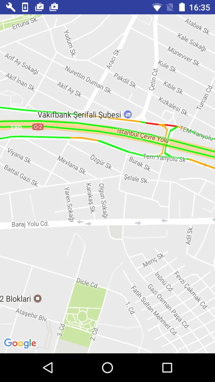 但是,在低缩放级别下,折线会重叠。
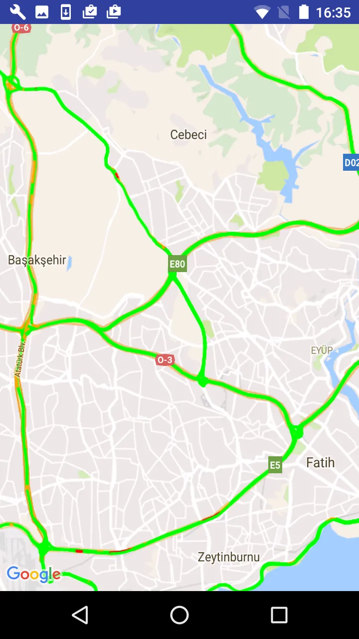 我的自定义瓦片提供程序类为:
但是,在低缩放级别下,折线会重叠。
我的自定义瓦片提供程序类为:public class PolylineTileProvider implements TileProvider {
private static final String TAG = "TileOverlay";
private final int mTileSize = 256;
private final SphericalMercatorProjection mProjection = new SphericalMercatorProjection(mTileSize);
private final int mScale = 2;
private final int mDimension = mScale * mTileSize;
private final List<PolylineOptions> polylines;
public PolylineTileProvider(List<PolylineOptions> polylines) {
this.polylines = polylines;
}
@Override
public Tile getTile(int x, int y, int zoom) {
Matrix matrix = new Matrix();
float scale = ((float) Math.pow(2, zoom) * mScale);
matrix.postScale(scale, scale);
matrix.postTranslate(-x * mDimension, -y * mDimension);
Bitmap bitmap = Bitmap.createBitmap(mDimension, mDimension, Bitmap.Config.ARGB_8888); //save memory on old phones
Canvas c = new Canvas(bitmap);
c.setMatrix(matrix);
drawCanvasFromArray(c, scale);
ByteArrayOutputStream baos = new ByteArrayOutputStream();
bitmap.compress(Bitmap.CompressFormat.PNG, 100, baos);
return new Tile(mDimension, mDimension, baos.toByteArray());
}
private void drawCanvasFromArray(Canvas c, float scale) {
Paint paint = new Paint();
paint.setAntiAlias(true);
paint.setStyle(Paint.Style.STROKE);
paint.setStrokeCap(Paint.Cap.ROUND);
paint.setStrokeJoin(Paint.Join.ROUND);
paint.setShadowLayer(0, 0, 0, 0);
paint.setAntiAlias(true);
if (polylines != null) {
for (int i = 0; i < polylines.size(); i++) {
List<LatLng> route = polylines.get(i).getPoints();
paint.setColor(polylines.get(i).getColor());
paint.setStrokeWidth(getLineWidth(polylines.get(i).getWidth(), scale));
Path path = new Path();
if (route != null && route.size() > 1) {
Point screenPt1 = mProjection.toPoint(route.get(0)); //first point
MarkerOptions m = new MarkerOptions();
m.position(route.get(0));
path.moveTo((float) screenPt1.x, (float) screenPt1.y);
for (int j = 1; j < route.size(); j++) {
Point screenPt2 = mProjection.toPoint(route.get(j));
path.lineTo((float) screenPt2.x, (float) screenPt2.y);
}
}
c.drawPath(path, paint);
}
}
}
private float getLineWidth(float width, float scale) {
return width / (scale);
}
}
谷歌地图安卓应用程序的交通图层非常好。 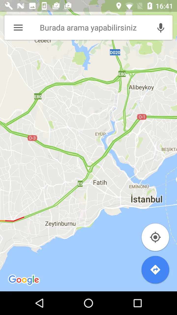
我该如何制作类似的图层?提前感谢。