请问有人能解释一下R语言中的addGeoJSON()功能是如何工作的吗?我看不懂文档。
?addGeoJSON => (map, geojson, layerId = NULL)
geojson和layerId是什么意思?
我已经通过GDAL导入了我的GeoJSON文件:
a1 <- readOGR(dsn = "myData.geojson", layer = "OGRGeoJSON")我该如何使用leaflet的addGeoJSON()函数访问列以绘制x,y坐标?
谢谢
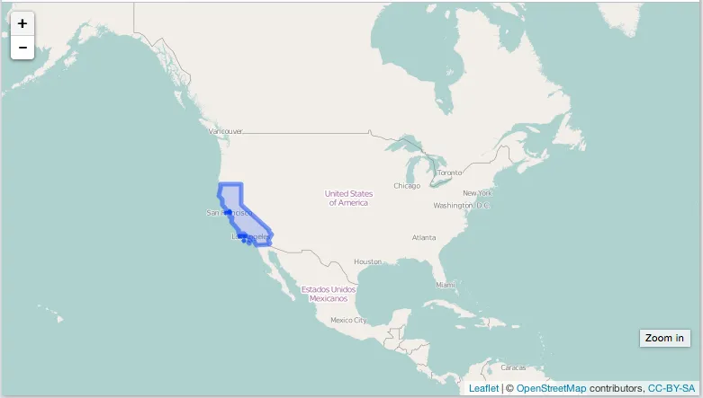
addGeoJSON的第一个参数是从调用leaflet()创建的leaflet对象。例如:url <- "https://raw.githubusercontent.com/glynnbird/usstatesgeojson/master/california.geojson"
geojson <- jsonlite::fromJSON(url)
library("leaflet")
leaflet() %>%
addTiles() %>%
setView(lng = -98.583, lat = 39.833, zoom = 3) %>%
addGeoJSON(geojson)
geojson对象替换通过readOGR读入的geojson。readOGR()函数。library("leaflet")
library("rgdal")
url <- "https://raw.githubusercontent.com/glynnbird/usstatesgeojson/master/california.geojson"
res <- readOGR(dsn = url, layer = "OGRGeoJSON")
leaflet() %>%
addTiles() %>%
setView(lng = -98.583, lat = 39.833, zoom = 3) %>%
addPolygons(data = res)
你应该用addPolygons(data = res, lng = "feature.properties.long", lat = "feature.properties.lat")替换addPolygons(data = res)。
对于你上面的例子应该有效。两者都可能返回一个SpatialPolygonsDataFrame类,你需要将其传递给leaflet()或addPolygons()中的data参数。
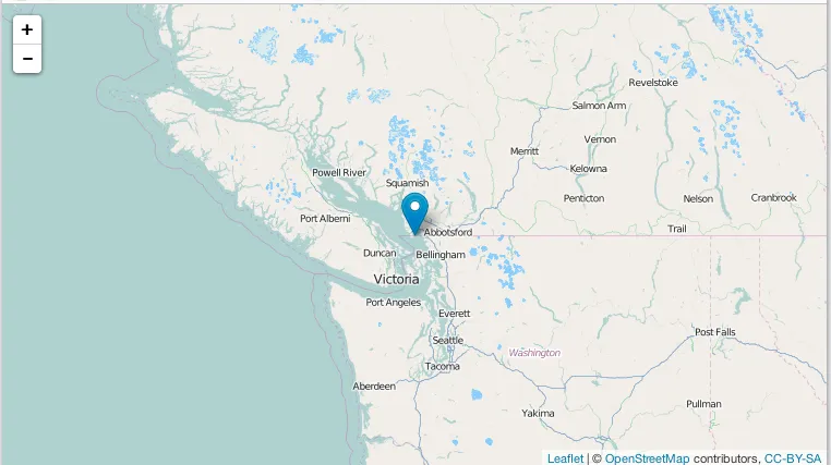
如果你从磁盘读取带有点的geojson文件,则可以使用:
geojson <- '{
  "type": "FeatureCollection",
  "features" :
  [
    {
      "type": "Feature",
      "geometry": {
        "type": "Point",
        "coordinates": [ -123, 49 ]
      },
      "properties": {
        "a_property": "foo",
        "some_object": {
          "a_property": 1,
          "another_property": 2
        }
      }
    }
  ]
}'
writeLines(geojson, "file.geojson")
res <- readOGR(dsn = "file.geojson", layer = "OGRGeoJSON")
leaflet() %>%
  addTiles() %>%
  setView(lng = -123, lat = 49, zoom = 6) %>%
  addMarkers(data = res)
readOGR(),稍等一下,刷新页面。 - sckottaddGeoJSON()函数 - 只有当你有geojson数据需要传递时才需要使用。readOGR函数应该将你读取的geojson转换为空间类对象。当你执行class(a1)时,你会得到什么? - sckott