我想计算两个不同数据集中两点之间的距离。我不想计算所有点之间的距离,只需要计算到数据集B中最近的点的距离。
例如: 数据集A - 人:http://pastebin.com/HbaeqACi 数据集B - 水源:http://pastebin.com/UdDvNtHs 数据集C - 城市:http://pastebin.com/nATnkMRk 因此...我想计算每个人到最近的水源点的距离。 我已经尝试过使用rgeos包进行计算,一开始遇到了一些投影错误,但后来解决了。但是这种方法会计算所有点之间的距离,而我只对与最近水源点的距离感兴趣。
有没有我漏掉的参数?或者我需要使用另一个包或函数吗?我还看了一下spatstat,它能够计算到最近邻居的距离,但不能计算两个不同数据集之间的距离:http://hosho.ees.hokudai.ac.jp/~kubo/Rdoc/library/spatstat/html/nndist.html
编辑:
完整的R脚本包括绘制数据集:
例如: 数据集A - 人:http://pastebin.com/HbaeqACi 数据集B - 水源:http://pastebin.com/UdDvNtHs 数据集C - 城市:http://pastebin.com/nATnkMRk 因此...我想计算每个人到最近的水源点的距离。 我已经尝试过使用rgeos包进行计算,一开始遇到了一些投影错误,但后来解决了。但是这种方法会计算所有点之间的距离,而我只对与最近水源点的距离感兴趣。
# load csv files
persons = read.csv("persons.csv", header = TRUE)
water = read.csv("water.csv", header = TRUE)
# change dataframes to SpatialPointDataFrame and assign a projection
library(sp)
library(rgeos)
coordinates(persons) <- c("POINT_X", "POINT_Y")
proj4string(persons) <- CRS("+proj=utm +datum=WGS84")
coordinates(water) <- c("POINT_X", "POINT_Y")
proj4string(water) <- CRS("+proj=utm +datum=WGS84")

# use rgoes package to calculate the distance
distance <- gDistance(persons, water, byid=TRUE)
# works, but calculates a huge number of distances
有没有我漏掉的参数?或者我需要使用另一个包或函数吗?我还看了一下spatstat,它能够计算到最近邻居的距离,但不能计算两个不同数据集之间的距离:http://hosho.ees.hokudai.ac.jp/~kubo/Rdoc/library/spatstat/html/nndist.html
编辑:
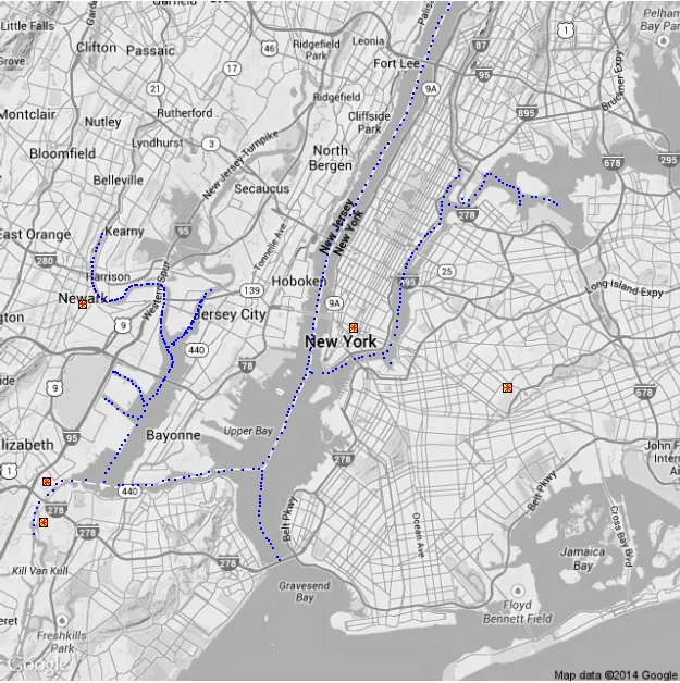
完整的R脚本包括绘制数据集:
library(RgoogleMaps)
library(ggplot2)
library(ggmap)
library(sp)
library(fossil)

#load data
persons = read.csv("person.csv", header = TRUE, stringsAsFactors=FALSE)
water = read.csv("water.csv", header =TRUE, stringsAsFactors=FALSE)
city = read.csv("city.csv", header =TRUE)

# plot data
persons_ggplot2 <- persons
city_ggplot2 <- city
water_ggplot2 <- water
gc <- geocode('new york, usa')
center <- as.numeric(gc)
G <- ggmap(get_googlemap(center = center, color = 'bw', scale = 1, zoom = 11, maptype = "terrain", frame=T), extent="device")
G1 <- G + geom_point(aes(x=POINT_X, y=POINT_Y ),data=city, shape = 22, color="black", fill = "yellow", size = 4) + geom_point(aes(x=POINT_X, y=POINT_Y ),data=persons, shape = 8, color="red", size=2.5) + geom_point(aes(x=POINT_X, y=POINT_Y ),data=water_ggplot2, color="blue", size=1)
plot(G1)

#### calculate distance
# Generate unique coordinates dataframe
UniqueCoordinates <- data.frame(unique(persons[,4:5]))
UniqueCoordinates$Id <- formatC((1:nrow(UniqueCoordinates)), width=3,flag=0)

# Generate a function that looks for the closest waterfeature for each id coordinates
NearestW <- function(id){
tmp <- UniqueCoordinates[UniqueCoordinates$Id==id, 1:2]
WaterFeatures <- rbind(tmp,water[,2:3])
tmp1 <- earth.dist(WaterFeatures, dist=TRUE)[1:(nrow(WaterFeatures)-1)]
tmp1 <- which.min(tmp1)
tmp1 <- water[tmp1,1]
tmp1 <- data.frame(tmp1, WaterFeature=tmp)
return(tmp1)
}

#apply to each id and the merge
CoordinatesWaterFeature <- ldply(UniqueCoordinates$Id, NearestW)
persons <- merge(persons, CoordinatesWaterFeature, by.x=c(4,5), by.y=c(2,3))
persons$nearest <- sapply(persons$Id, NearestW)后,我得到了以下错误:_Error in$<-.data.frame(*tmp*, "nearest", value = list()) : replacement has 0 rows, data has 164_。我已经将其保存到一个新的数据框中,使用persons_nearest <- sapply(persons$Id, NearestW),但输出为空列表。 - schlomm