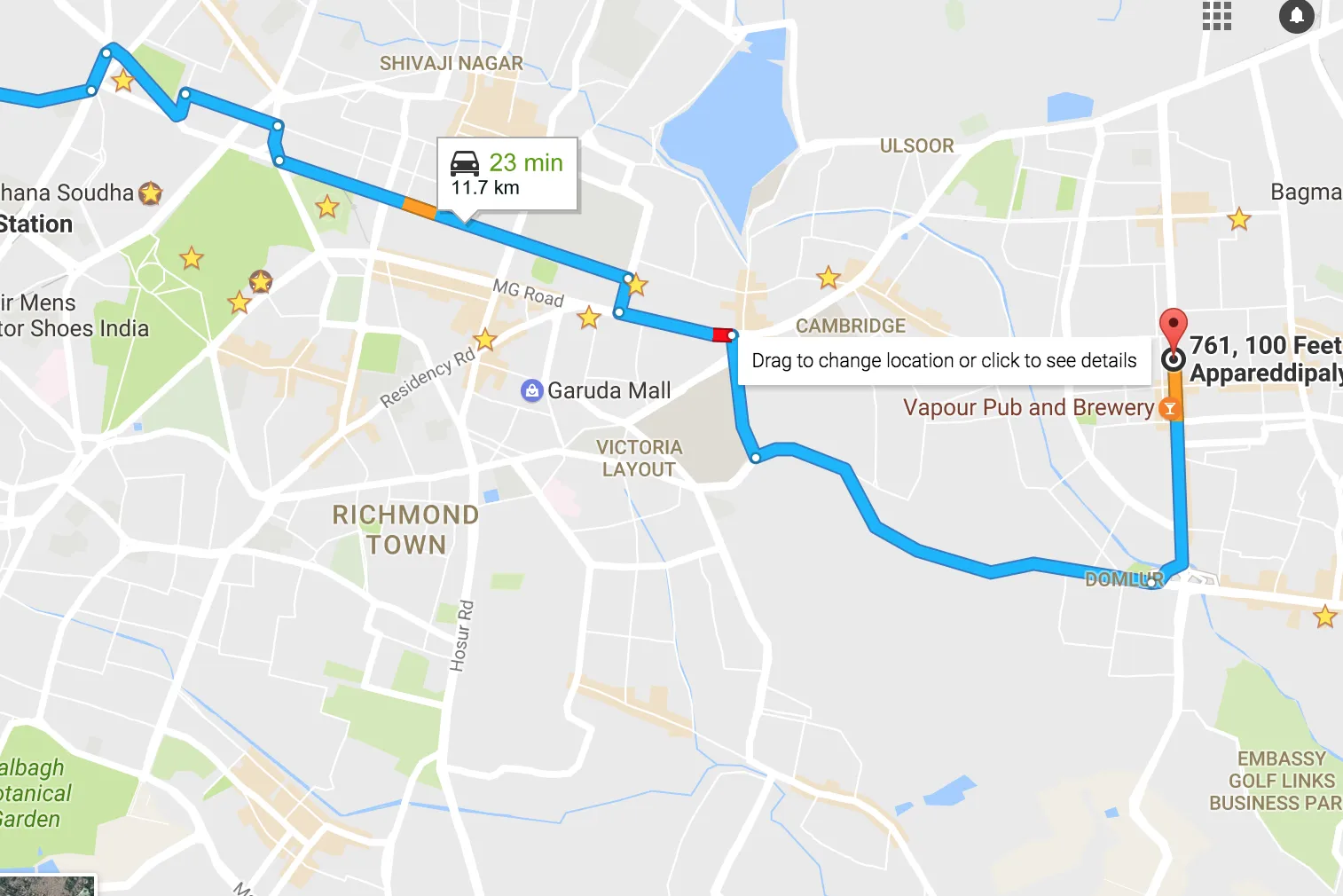
我已经在浏览器/JavaScript中使用Google Maps V3方向API实现了从起点到终点的路线查询。现在,我想在路线部分仅显示如下快照中所示的交通情况(来自Google Maps)。
这是我的输出快照: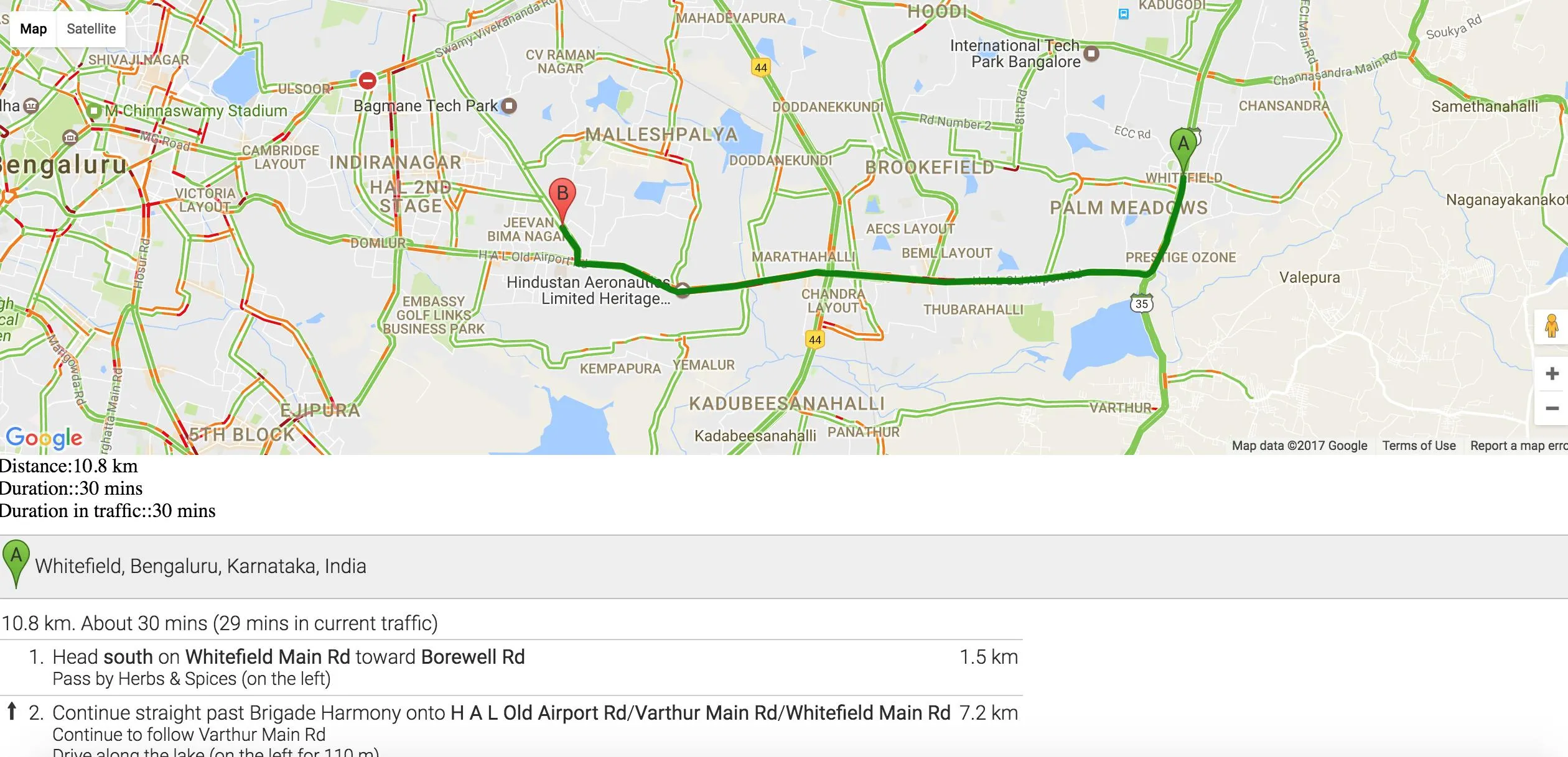 我希望这可以帮助你理解我的问题。如果需要其他信息,请告诉我。
是否有一种方法可以针对不同的交通状况级别使用不同的折线颜色?
如果无法使用方向 API 或交通图层,我是否可以利用定向矩阵或道路 API 的高级版本来实现这一点?
以下是我目前为止所做的以及相应的输出:
  var map;
  var directionsService;
  var polyline;
  var directionsDisplay;
  function initMap() {
    directionsDisplay = new google.maps.DirectionsRenderer({
      polylineOptions:{
        strokeOpacity:1,
        strokeWeight:5,
        strokeColor: 'green'
      },
      draggable: true
    });

    directionsService = new google.maps.DirectionsService;
    map = new google.maps.Map(document.getElementById('map'), {
      zoom: 14,
      center: {lat: 37.77, lng: -122.447}
    });

    var trafficLayer = new google.maps.TrafficLayer();
    trafficLayer.setMap(map);

    directionsDisplay.setMap(map);
               directionsDisplay.setPanel(document.getElementById('directionsPanel'));

    directionsDisplay.addListener('directions_changed', function() {
      DistanceOut(directionsDisplay.getDirections());
    });
    polyline = new google.maps.Polyline({
      map:map
    });
    calculateAndDisplayRoute(directionsService, directionsDisplay);

  }

  function calculateAndDisplayRoute(directionsService,    directionsDisplay) {

    directionsService.route({
      origin: 'Whitefield, Bangalore',
      destination: 'Indira nagar, Bangalore',

      provideRouteAlternatives: true,
      travelMode: 'DRIVING',
      drivingOptions: {
        departureTime: new Date(Date.now()),
        trafficModel: 'bestguess'
      },
      unitSystem: google.maps.UnitSystem.METRIC

    }, function(response, status) { console.log(response);
      if (status == 'OK') {
        directionsDisplay.setDirections(response);
        DistanceOut(response);
        changeStepColor(response);
      } else {
        window.alert('Directions request failed due to ' + status);
      }
    });
  }

  function DistanceOut(response){
    document.getElementById("travelDetail").innerHTML = "Distance:"+response.routes[0].legs[0].distance.text+
        "<br> Duration::"+response.routes[0].legs[0].duration.text+
        "<br> Duration in traffic::"+response.routes[0].legs[0].duration_in_traffic.text;
  }

  // Here I want to change the polyline color according to the traffic condition.
  // Can I? Or if any other way to do so?!
  function changeStepColor(res){
    var steps = res.routes[0].legs[0].steps;

    for(i=0; i<steps.length; i++){
      if((steps[i].distance.value/steps[i].duration_in_traffic.value) > 5) {
        //steps[i].polyline.strokeColor='blue';
        //directionsDisplay.setOptions({polylineOptions: {path: steps[i].path ,strokeColor: 'red'}});
      } else {
        //directionsDisplay.setOptions({polylineOptions: {path: steps[i].path ,strokeColor: 'yellow'}});

        //steps[i].polyline.strokeColor='red'
      }
    }
  }
这是我的输出快照:
我希望这可以帮助你理解我的问题。如果需要其他信息,请告诉我。