如何使从数据库加载到地图上的多边形可编辑?
目前,当多边形加载时,它们保持不可编辑状态。只有在创建新多边形时才启用编辑选项。
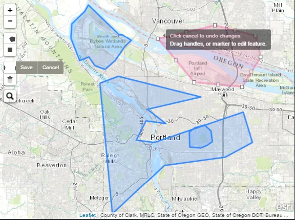
从数据库加载的多边形标记为蓝色,新创建的多边形标记为红色。(编辑图标出现了问题!)
如何使从数据库加载到地图上的多边形可编辑?
目前,当多边形加载时,它们保持不可编辑状态。只有在创建新多边形时才启用编辑选项。
从数据库加载的多边形标记为蓝色,新创建的多边形标记为红色。(编辑图标出现了问题!)
let map = L.map("map").setView([41.31, 69.27], 12);
L.tileLayer("http://{s}.tile.osm.org/{z}/{x}/{y}.png").addTo(map);

let drawnItems = new L.FeatureGroup();
map.addLayer(drawnItems);
var drawControl = new L.Control.Draw({
  draw: {. . .},
  edit: {
    featureGroup: drawnItems,
    poly: {
      allowIntersection: false
    }
  }
});
map.addControl(drawControl);

map.on("draw:edited", function(e) {
  let layers = e.layers;
  layers.eachLayer(function(layer) {
    console.log(layer);
  });
});